
Your average Los Angeles fender bender typically shows more damage than this crashed "space object."
Is the guy in the white robe and turban paying his respects, with his oh-so-properly bowed head, to something that has died? Maybe he knows that his little psyop has been 'outed'. What's up with the different angles of the shadows?lux wrote:
Your average Los Angeles fender bender typically shows more damage than this crashed "space object."
Boom! NASA to Demolish Spacecraft in the Name of Science
The spacecraft will be the target of a future hypervelocity impact experiment to examine the physical characteristics of debris created when two satellites collide.
NASA and the Air Force's Space and Missile Systems Center are co-sponsors of DebriSat. The NASA Orbital Debris Program Office at the Johnson Space Center in Houston is leading the effort. [Photos: Space Debris Images & Cleanup Concepts]
Impact risk assessments
Data gleaned from demolishing DebriSat will be valuable in the short- and long-term, said J. C. Liou of NASA's Orbital Debris Program Office.
"Collision fragments are expected to dominate the future orbital debris environment," Liou told SPACE.com. Therefore, he said, a high fidelity breakup model describing the outcome of a satellite collision — in terms of the fragment size, mass, area-to-mass ratio, shape, and composition distributions — is needed for reliable short- and long-term impact risk assessments.
Those appraisals deal with debris as small as 1 millimeter for critical space assets and for good orbital debris environment definition, Liou said. Some of the distributions for "large" fragments can be obtained from the U.S. Space Surveillance Network (SSN) observations. But the SSN data are limited to 10-centimeter (4 inches) and larger objects. "Laboratory-based experiments are necessary to collect data for smaller debris," he said.
...
With the exception of software, all other aspects of the satellite's design, fabrication, and assembly integration and testing will be as rigorous as that of an actual flight vehicle, according to officials involved in the DebriSat effort.
As a modern satellite target, obliterating DebriSat is expected to improve the NASA standard satellite breakup model.
...
Once busted up, how much work is involved in piecing together just how the satellite reacted to the impact?
"We are not actually gluing the satellite back together," Fitz-Coy said. "Rather we are characterizing — size, shape, etc. — of the fragments resulting from the impact. This is a labor intensive exercise. [FMB - And a meaningless one.]"
http://news.yahoo.com/boom-nasa-demolis ... 15982.html
US Military Enlists Amateurs to Track Space Junk
The U.S. military is launching a far-out neighborhood watch. But instead of warding off burglars, these amateur watchdogs are tracking orbital debris and possible satellite collisions in Earth orbit.
The sky-monitoring project, called SpaceView, is a Defense Advanced Research Projects Agency (DARPA) program that enrolls the talents of amateur astronomers to help protect American space assets from orbital trash.
The vision behind the DARPA SpaceView program is to provide more diverse data to the Space Surveillance Network, a U.S. Air Force program charged with cataloguing and observing space junk and debris to identify potential near-term collisions. NASA estimates more than 500,000 pieces of hazardous space debris orbit the Earth, threatening satellites that support peacekeeping and combat missions.
These dangerous objects include spent rocket stages, defunct satellites and fragments from other spacecraft that are the result of erosion, explosion and collision, according to a DARPA statement. A collision between one of these small pieces of debris and a satellite could release more than 20,000 times the energy of a head-on automobile collision at 65 mph (105 kph), the statement adds.
It’s a mess in orbit, and SpaceView officials are actively seeking information from individual amateur astronomers about their equipment, sites and observing habits to help keep a trained eye on this untidy state of affairs.
http://news.yahoo.com/us-military-enlis ... 49423.html

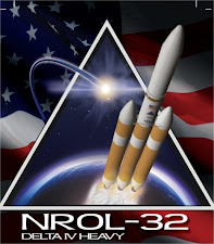
Here is a "flight simulation":USA-223, known before launch as NRO Launch 32 (NRO L-32), is an American reconnaissance satellite which was launched in 2010. It is operated by the United States National Reconnaissance Office.
Whilst details of its mission are officially classified, amateur observers have identified USA-223 as the fifth Mentor satellite. Mentor spacecraft are used for electronic signals intelligence, and carry large antennas to enable them to intercept radio transmissions. These antennas are believed to have a diameter of around 100 metres (330 ft). Bruce A. Carlson, the director of the NRO, described the spacecraft as being the largest satellite ever launched.
USA-223 was launched by United Launch Alliance, aboard a Delta IV Heavy carrier rocket flying from Space Launch Complex 37B at the Cape Canaveral Air Force Station. The launch occurred at 22:58 UTC on 21 November 2010. Following liftoff the rocket flew East towards a geosynchronous orbit. By 23:05 UTC, official updates on the status of the launch had been discontinued.
By December 1993, GPS achieved initial operational capability (IOC), indicating a full constellation (24 satellites) was available and providing the Standard Positioning Service (SPS).[24]
Full Operational Capability (FOC) was declared by Air Force Space Command (AFSPC) in April 1995, signifying full availability of the military's secure Precise Positioning Service (PPS).[24]
https://en.wikipedia.org/wiki/Global_Positioning_SystemGPS was created and realized by the U.S. Department of Defense (DoD) and was originally run with 24 satellites. It became fully operational in 1994.
http://www.ehow.com/about_5569665_globa ... ented.htmlThe Global Positioning System became fully operational on April 27, 1995. Prior to that date, the long and complex process of launching and synchronizing satellites had been going on for years. Since the mid-1990s, GPS usage has spread widely and today millions of people use GPS navigation devices in their cars, aircraft, boats, or for any number of outdoor activities.
https://en.wikipedia.org/wiki/History_of_mobile_phonesThe first machine-generated SMS message was sent in the UK on 3 December 1992 followed in 1993 by the first person-to-person SMS sent in Finland.
First of the new companies to offer a digital service was Mercury. Their One2One network offered limited coverage, initially in the M25 area only. The service launched on 7 September 1993 with two new phones
Orange had almost national coverage, excepting Wales, when it launched on 28 April 1994.
http://www.mobilephonehistory.co.uk/his ... istory.phpLowCall offered lower handset prices, but higher call chargers to less frequent users. In the Autumn of 1993 they launched MetroDigital as a direct competitor to Mercury's struggling One2One service.
On 6 August 1991, the World Wide Web went live to the world.
The first image was uploaded in 1992,
http://thenextweb.com/insider/2011/08/0 ... he-public/In 1993, it was announced by CERN that the World Wide Web was free for everyone to use and develop, with no fees payable
Each GPS satellite transmits two carrier signals in the microwave range, designated as L1 and L2 (frequencies located in the L-Band between 1000 and 2000 MHz).
Civil GPS receivers use the L1 frequency with 1575.42 MHz (wavelength 19.05 cm). The L1 frequency carries the navigation data as well as the SPS code (standard positioning code). The L2 frequency (1227.60 MHz, wavelength 24.45 cm) only carries the P code and is only used by receivers which are designed for PPS (precision positioning code). Mostly this can be found in military receivers.
http://www.kowoma.de/en/gps/signals.htmFrequencies should be chosen below 2 GHz, as frequencies above 2 GHz would require beam antennae for the signal reception
Ionospheric delays are enormous for frequency rages below 100 MHz and above 10 GHz
https://en.wikipedia.org/wiki/History_of_mobile_phonesIn 1991 the first GSM network (Radiolinja) launched in Finland. In general the frequencies used by 2G systems in Europe were higher than those in America, though with some overlap. For example, the 900 MHz frequency range was used for both 1G and 2G systems in Europe,
https://en.wikipedia.org/wiki/Cellular_frequenciesDue to historical reasons, radio frequencies used for cellular networks differ in the Americas, Europe, Africa and Asia. The first commercial standard for mobile connection in the United States was AMPS, which was in the 800 MHz frequency band. In Nordic countries of Europe, the first widespread automatic mobile network was based on the NMT-450 standard, which was in the 450 MHz band. As mobile phones became more popular and affordable, mobile providers encountered a problem because they couldn't provide service to the increasing number of customers. They had to develop their existing networks and eventually introduce new standards, often based on other frequencies. Some European countries (and Japan) adopted TACS operating in 900 MHz. The GSM standard, which appeared in Europe to replace NMT-450 and other standards, initially used the 900 MHz band too. As demand grew, carriers acquired licenses in the 1,800 MHz band. (Generally speaking, lower frequencies allow carriers to provide coverage over a larger area, while higher frequencies allow carriers to provide service to more customers in a smaller area.)
In the U.S., the analog AMPS standard that used the cellular band (800 MHz) was replaced by a number of digital systems. Initially, systems based upon the AMPS mobile phone model were popular, including IS-95 (often known as "CDMA", the air interface technology it uses) and IS-136 (often known as D-AMPS, Digital AMPS, or "TDMA", the air interface technology it uses). Eventually, IS-136 on these frequencies was replaced by most operators with GSM. GSM had already been running for some time on US PCS (1,900 MHz) frequencies.
And, some NMT-450 analog networks have been replaced with digital networks using the same frequency. In Russia and some other countries, local carriers received licenses for 450 MHz frequency to provide CDMA mobile coverage area.
Many GSM phones support three bands (900/1,800/1,900 MHz or 850/1,800/1,900 MHz) or four bands (850/900/1,800/1,900 MHz), and are usually referred to as tri-band and quad-band phones,
http://computer.howstuffworks.com/inter ... ternet.htmThe first of those components is hardware. That includes everything from the cables that carry terabits of information every second to the computer sitting in front of you.
Other types of hardware that support the Internet include routers, servers, cell phone towers, satellites, radios, smartphones and other devices. All these devices together create the network of networks.
and alsoFrequencies should be chosen below 2 GHz, as frequencies above 2 GHz would require beam antennae for the signal reception
Ionospheric delays are enormous for frequency rages below 100 MHz and above 10 GHz
http://electriciantraining.tpub.com/141 ... 182_85.htmSky waves, on the other hand, suffer most of their absorption losses because of conditions in the ionosphere. Note that some absorption of sky waves may also occur at lower atmospheric levels because of the presence of water and water vapor. However, this becomes important only at frequencies above 10,000 megahertz.
http://en.wikipedia.org/wiki/Ultra_high_frequencyAmateur radio enthusiasts primarily use this quality of the ionosphere to help propagate lower frequency HF signals around the world: the waves are trapped, bouncing around in the upper layers of the ionosphere until they are refracted down at another point on the Earth. This is called skywave transmission. UHF TV signals are not carried along the ionosphere but can be reflected off of the charged particles down at another point on Earth in order to reach farther than the typical line-of-sight transmission distances; this is the skip distance. UHF transmission and reception are enhanced or degraded by tropospheric ducting as the atmosphere warms and cools throughout the day.
http://en.wikipedia.org/wiki/Ultra_high_frequencyUltra-high frequency (UHF) designates the ITU radio frequency range of electromagnetic waves between 300 MHz and 3 GHz (3,000 MHz)
(except your own physical body!The highly diluted gas in this layer can reach 2,500 °C (4,530 °F) during the day. Even though the temperature is so high, one would not feel warm in the thermosphere, because it is so near vacuum that there is not enough contact with the few atoms of gas to transfer much heat.
http://greenliving.nationalgeographic.c ... 20500.htmlThe energy production efficiency of solar panels drops when the panel reaches hot temperatures. A field experiment in the United Kingdom revealed a drop of 1.1% of peak output for every increase in degrees Celsius of a home photovoltaic solar panel once the panel reached 42 degrees Celsius, or about 107 degrees Fahrenheit.
http://web.mit.edu/newsoffice/2010/melt ... -0802.htmlsilicon ordinarily melts at 1414 degrees C
http://en.wikipedia.org/wiki/Solar_panels_on_spacecraftSpacecraft operating in the inner solar system usually rely on the use of photovoltaic solar panels to derive electricity from sunlight.
http://blog.testfreaks.com/information/ ... ne-towers/Calls are generally routed to a land-based T3 line laid underground in order to reach their destinations, but sometimes back up to a wireless antenna signal if the ground connection is poor (or nonexistent). These wired connections are more solid and trustworthy, which is why they are the preferred method of transmission.
And lo and behold the answer is:These fiber optic cables carry DWDM (http://en.wikipedia.org/wiki/Wav...) laser signals ( TCP/IP packets etc. ) at a rate of terabytes per second. They use optical repeaters to strengthen the signal which attenuates over long distances. These are powered by copper cables shown above.They have a decade lifespan and costs vary (depending on the length of the cable). Typical costs for projects are anywhere from US$ 100 Million to $500 Million. Do private telecommunications companies own the undersea cables that connect the internet across continents?
http://www.quora.com/Do-private-telecom ... continentsYes, the cables are owned by the various PTT or Transit carriers who would be utilizing (tapping) into the cable system. These companies are referred to as the O&M (Operations and Maintenance) companies of the cable system.
http://www.quora.com/How-are-major-unde ... -the-oceanWe don't use satellites because they can't carry terabytes of data for less than a billion dollars per communication line.