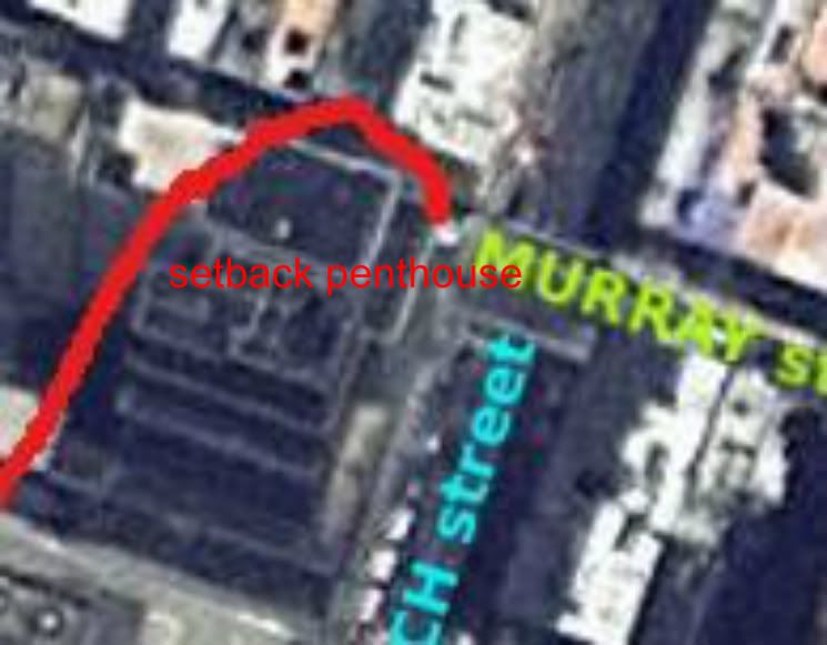
whatsgoingon wrote:Something I noticed. The Pizza Joint tells us that the photo with the green and cyan street labels is backwards. The street is Church that the projectile flew down. Murray is the cross-street. To get a reference you need to look at the pizza shop on Google Streetview today. It is a different pizza shop called, "Star." Yeah it is run by the Masons ;-) But that is the reference point -- the pizza shop. Starbucks is Catty-Corner (diagonal corner to the engine crash corner).
The engine crash corner is adjacent to the Pizza shop. Murray St runs between Pizza Shop and the crash site corner!
Au contraire...my read of the present-day topology is that the crash-site is now a Dunkin' Donuts in Murray...facing south, of course, with right-hand-corner-to-Church. And 'Famous Pizza' facing west is now a nondescript 'Condiminiums' multiplex.whatsgoingon wrote: The engine crash corner is adjacent to the Pizza shop. Murray St runs between Pizza Shop and the crash site corner!
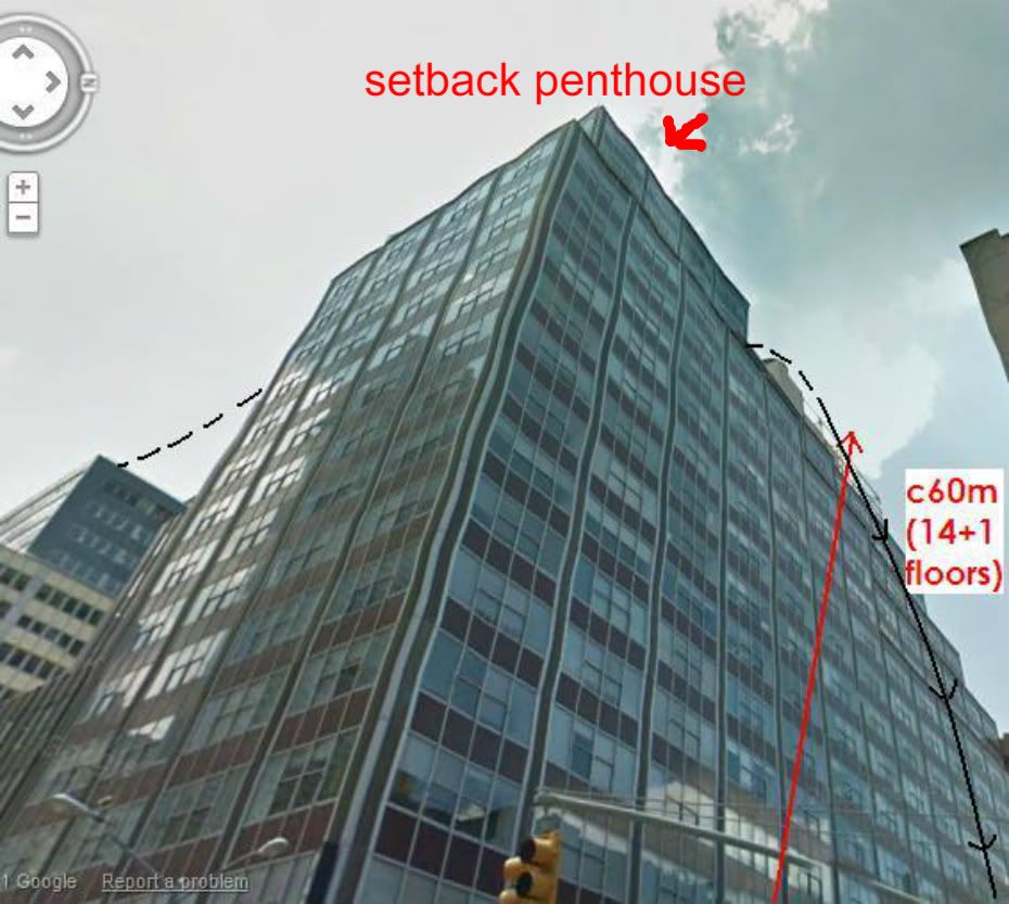
'Star' Pizza's not in the historical frame for the LZ, because when you make it right-hand-corner-to-Church, it's facing north...now that turbine sub-assembly's not very aerodynamic already, so a hairpin180 at the intersection is just too much...!-)
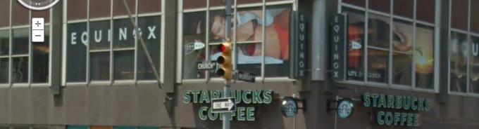
So that maintains the site of the present-day Starbucks/Equinox 60m multiblock, at 50-54 Murray, as having been the north-facing downhill slope of the canyon silo....
Stand at the intersection of Church+Murray, do a 360 with a nod south to WTC, advance west up Murray to just before the blue Ob-Gyn sign on the north sidewalk, do a plus/minus 120 looking back to the intersection, now tell me I'm wrong.